trajectory of weather-balloons
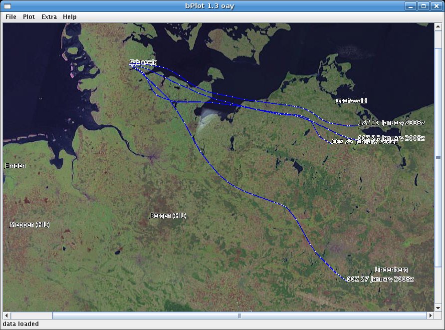
strong winds over Schleswig-Holstein
(map Courtesy NASA/JPL-Caltech)
strong winds over Schleswig-Holstein
(map Courtesy NASA/JPL-Caltech)
Radio direction finding is not the only way to gather information about the trajectory of weather-balloons. The program shown in the screenshot above displays (relying on data provided by an US weather-site) the trajectories of weather-balloons (analysis, 12h-72h forecast in 12h-steps). The program is written in Java, needs a connection to the Internet for downloading the data and maps of the starting site as gif- or jpg-file. The program displays the flight paths for any given location. It cannot be downloaded here, but will be provided on request.
back to the homepage